Good morning everyone! Or afternoon, or evening. Whatever your timezone strikes at when you’re reading this.
I wanted to narrate the events of a holiday I took on January 4th, Sunday. On sundays entrance to the site is free, so we booked it and went there first thing in the morning. It took around an hour to drive from Veracruz, and during the trip I took many photos I wanted to share.
Quiahuiztlan: The place of the Rain
Oh, you don’t know what Quiahuiztlan is? It’s a very important site regarding the history of the end of Prehispanic Mexico and its following Conquest. You know what? I’m going to leave you with what was written on the site’s information board, instead. It explains everything you need to know about the site.
All information was provided the Instituto Nacional de Antropología e Historia (INAH)
Thanks to the archeological studies conducted at this site, we know that people of Totonac affiliation used to live here. As a defensive strategy, Quiahuiztlan was settled on the Bernal Hill, also called Cerro de los Metates. The constructors of the city used terraces to avoid the soil to slide down. At the same time, they introduced walls that worked as a defensive system, making it difficult for the invaders to access. Between A. D. 800 and 900 the Toltecs invaded the city and subjugated the inhabitants. At the beginning of the 13th century, the Aztecs also conquered the city.
In Quiahuiztlan, mausoleum style tombs were found. These tombs have the shape of miniature temples and they were unique in ancient Mexico. The tombs are distributed in three main cemeteries. Some members of the nobility were buried in these tombs together with beautifully fashioned ceramic offerings.
Quiahuiztlan is also famous due to the fact that during the journey of Cortés, a church and a fortified enclosure were built in the nearby lowlands and small hills. This place was called “Villa Rica de la Vera Cruz”, and it is considered the first Spanish settlement in Mexico. In this place an alliance with the Europeans and 30 Totonacan towns was established. This fact facilitated, one way or another, the Conquest of Mexico.
You are in an unique site. Besides the exceptional tombs and the astounding architecture in the middle of the hill, historical events of vital significance ocurred in this place. We invite you to experience this place, enjoy the natural environment, and help us protect it. This Cultural Heritage site belongs to all of us.
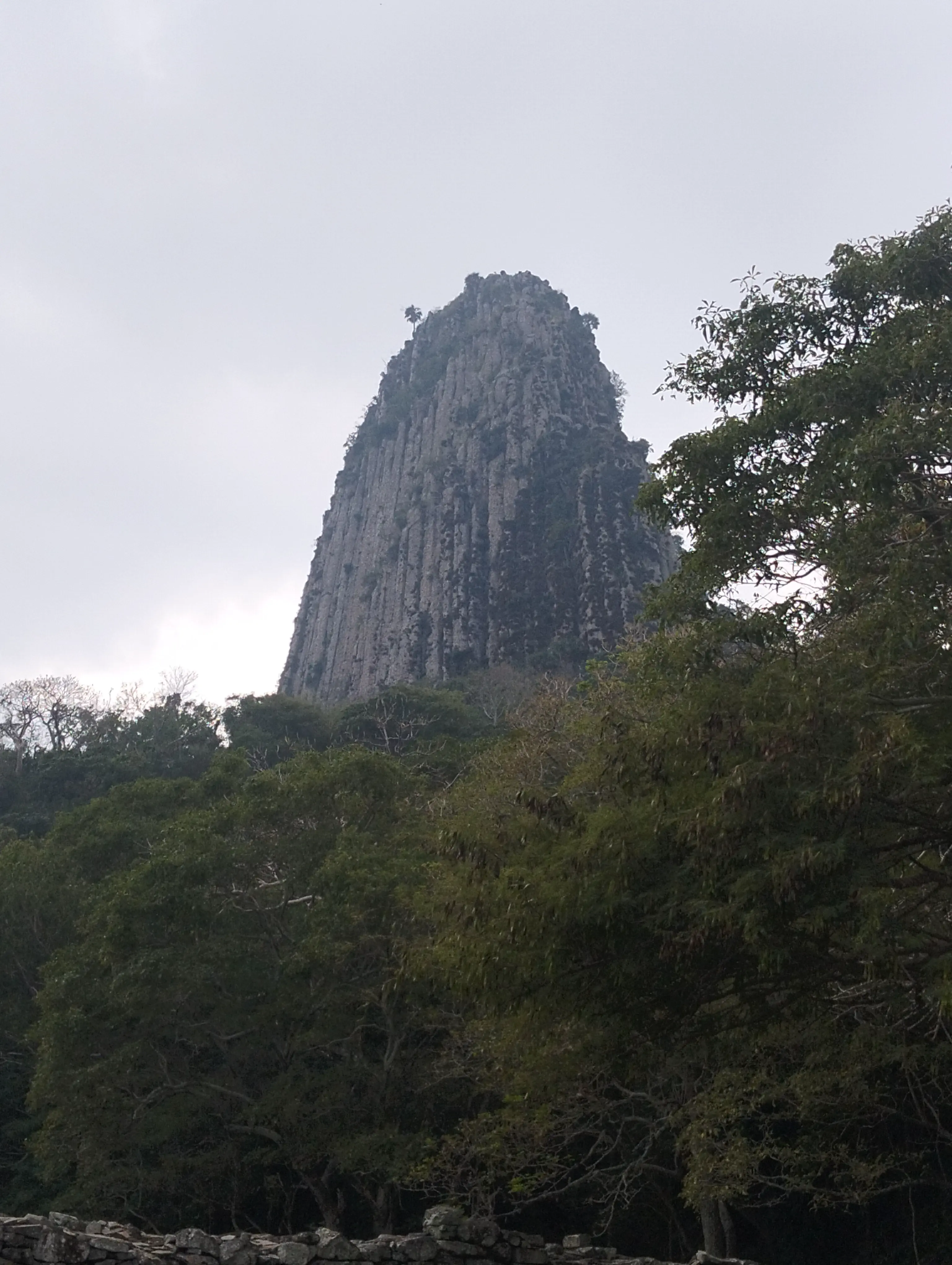
Bernall Hill, also known as Cerro de los Metates, seen from the parking lot of Quiahuiztlan Heritage site
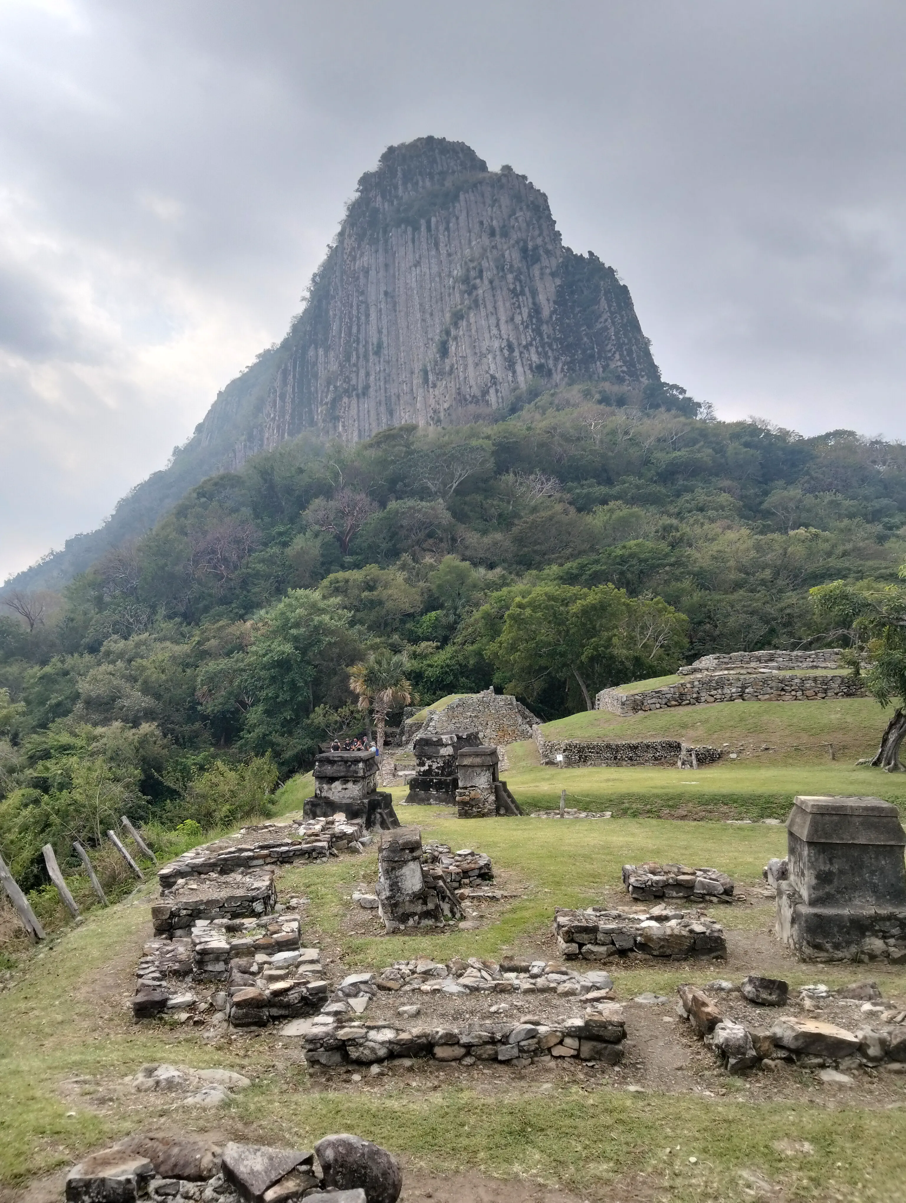
Bernall Hill, seen from one of the three cementaries of Quiahuiztlan
Because I have many images here, I’ll split them in topical tabs for your convinience. Keep in mind any information I add here was from second-hand guides and complemented from the internet.
As mentioned on the information board, there are a lot of tombs here. What’s unique about them is the fact they are shaped in the style of little houses or mausoleums. Currently there are no signs that indicate who each tomb belonged to, but I like to think they all belonged to a special someone of a family that lieved in Quiahuiztlan. Take a look at this row of tombs, for example.
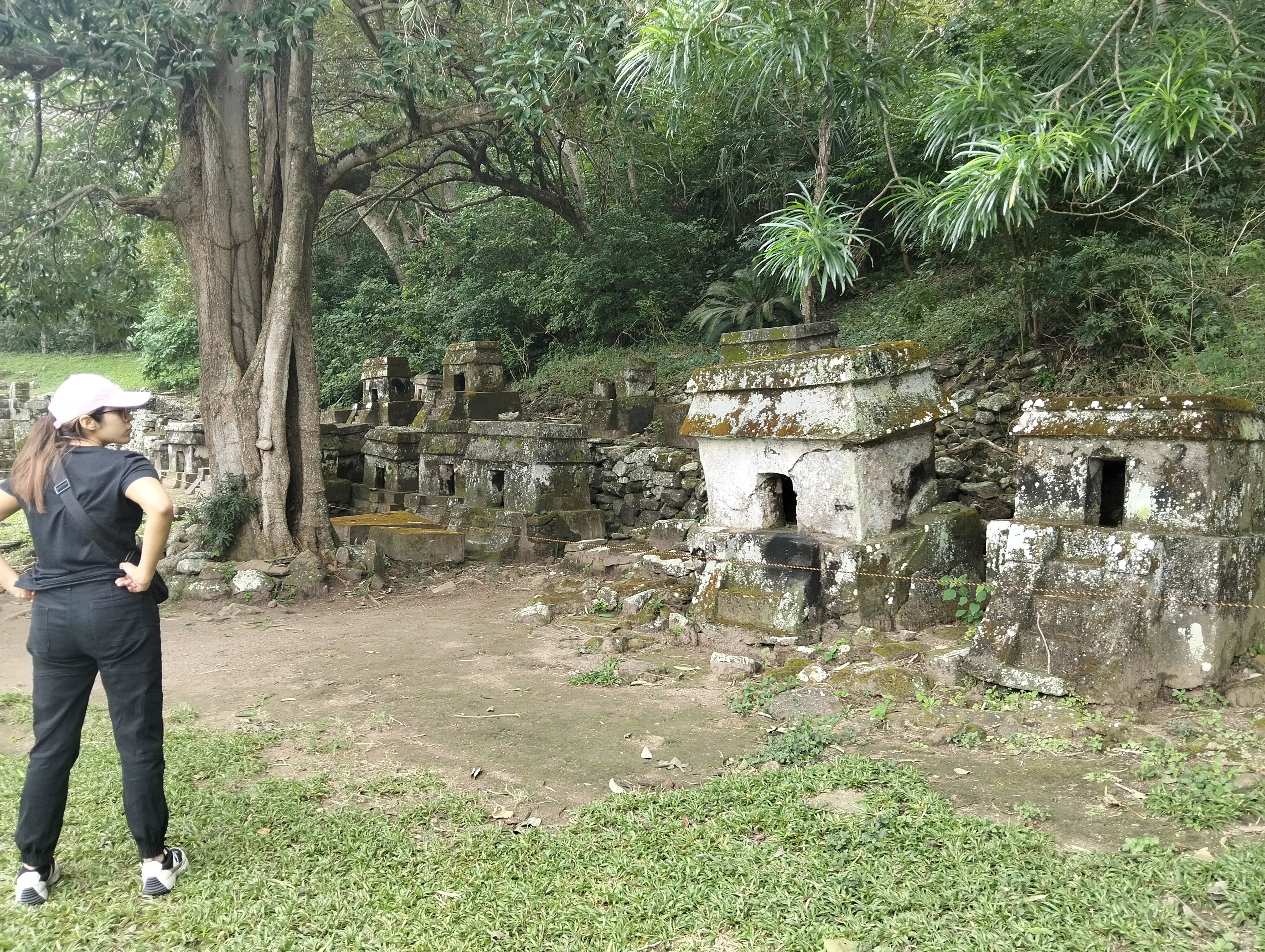
One of the mausoleum tombs that are in Quiahuiztlan. Their size vary, but all hold the same shape. Also sister jumpscare.
Before you ask, no, they are not made from one piece. They were actually made with several stones, and smooth out using something akin to plaster! Their base is hollow, and is where the bones of the dead were most likely held, or its either because it was cheaper to build it that way. That’s a conjecture, do not take my hypothesis seriously.
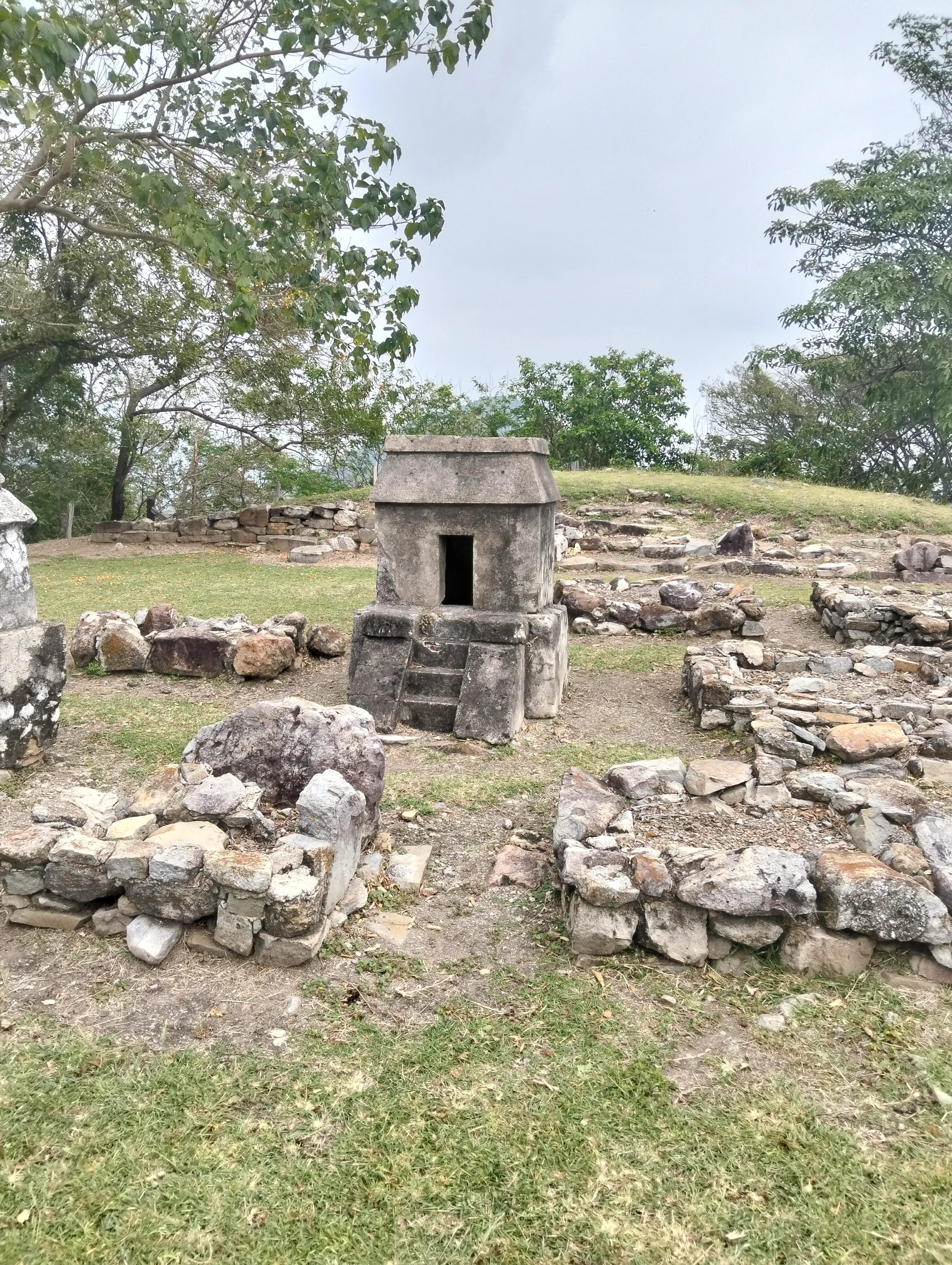
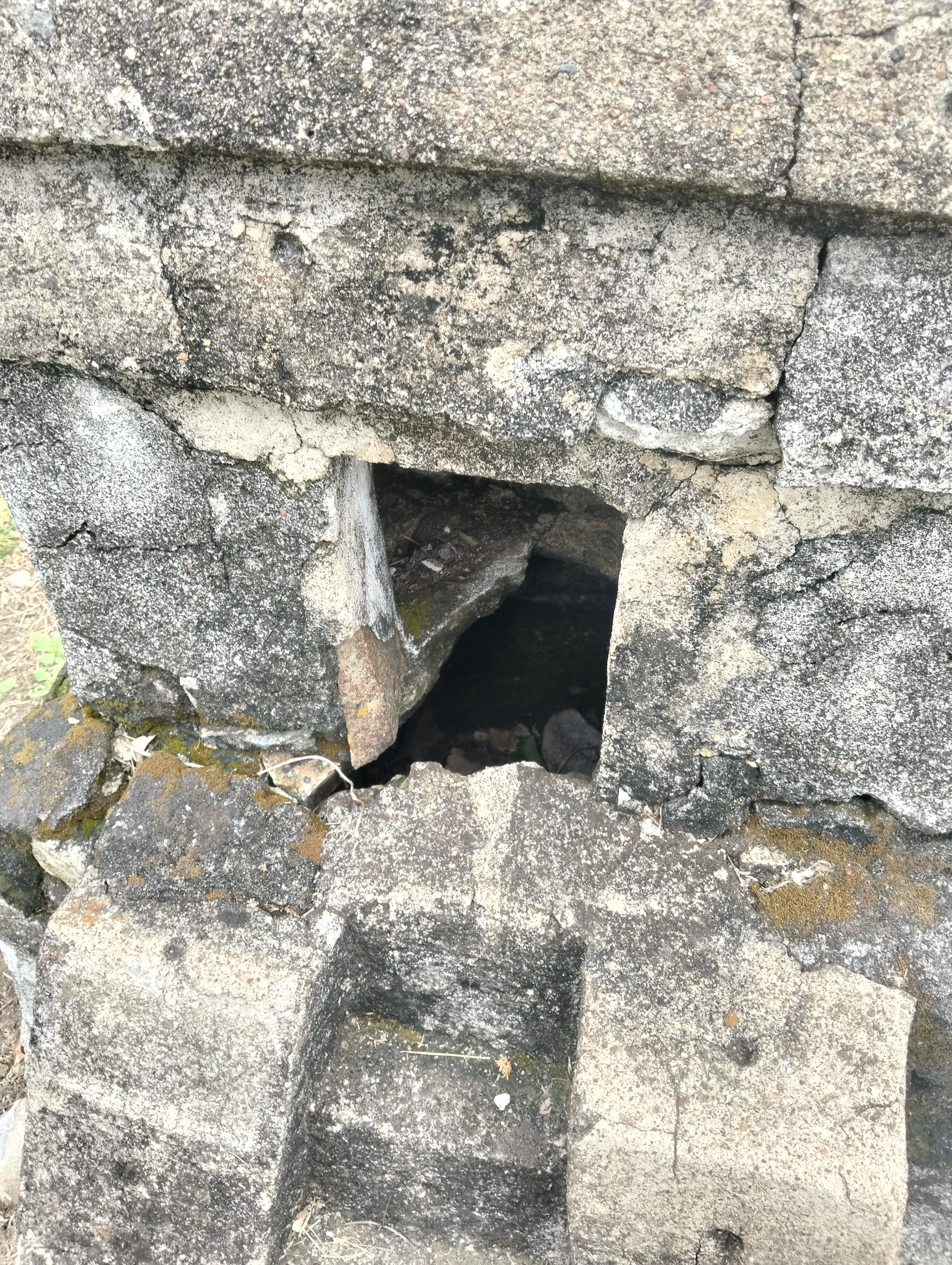
The inside of one of the tombs. You can see the base of the mausoleum was broken, revealing the base to be hollow on the inside.
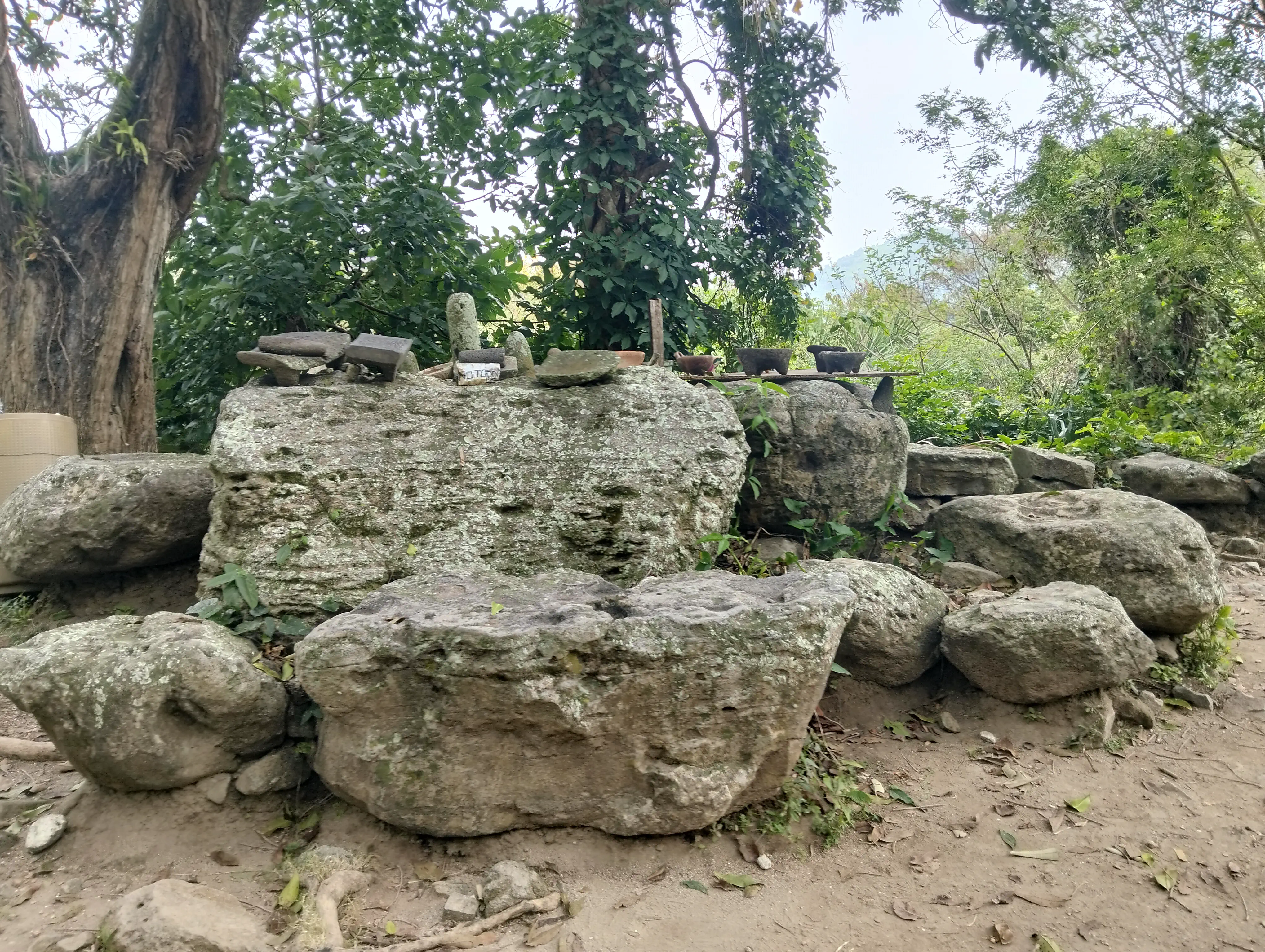
An improvised display of molcajetes on a rock.
First of all. What is a petate? It’s a special kind of tapestry used in Mesoamerica, woven with palm leaves and was used for ceremonial uses, denote wealth or even just as a bed. It was used everywhere for both common and special ocassions.
You can find more information in this news article explaning its influence of mexican culture, or how it was linked to power and authority.
Quiahuiztlan is also called “The mount of petates” because initial archeological explorations found many of these tapestries on the site; though today you cannot see them on site because the ones that were found are either in an INAH archive, or as trophies from archeologists who weren’t as professional as they should have. In hindsight, it was obvious I wasn’t going to see any tepates there.
What was displayed there, were molcajetes. A molcajete is basically a grinder and mortar set made out of stone, used to crush spices and the like. They’re most commonly decorated to have the head of a pig on one side, because it’s cute that way.
Some molcajetes that were found on the site are shown on the image above, though I have to apologize for not photographing them in detail.
Quiahuiztlan was the first settlement to see Cortes’ ships, and their alliance with his armies, along with the rest of the Totonacan towns would sign the fate of the country.
Do you imagine being a gardener cleaning the tombs of your nobles, and seeing from THIS view a huge structure landing on the beach, and a few days later the men that came out of the sea knock on your door? I would be terrified, if you ask me.
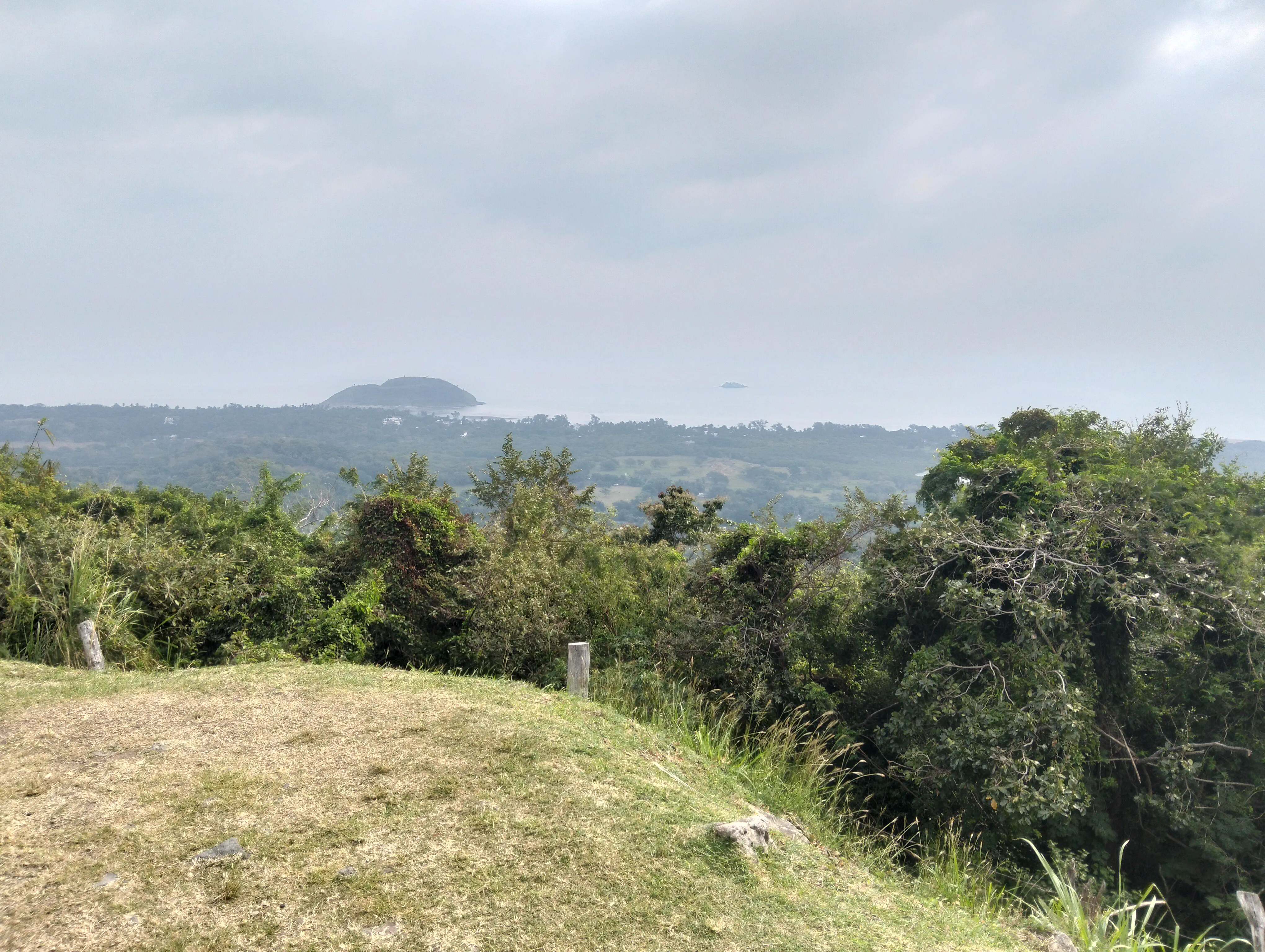
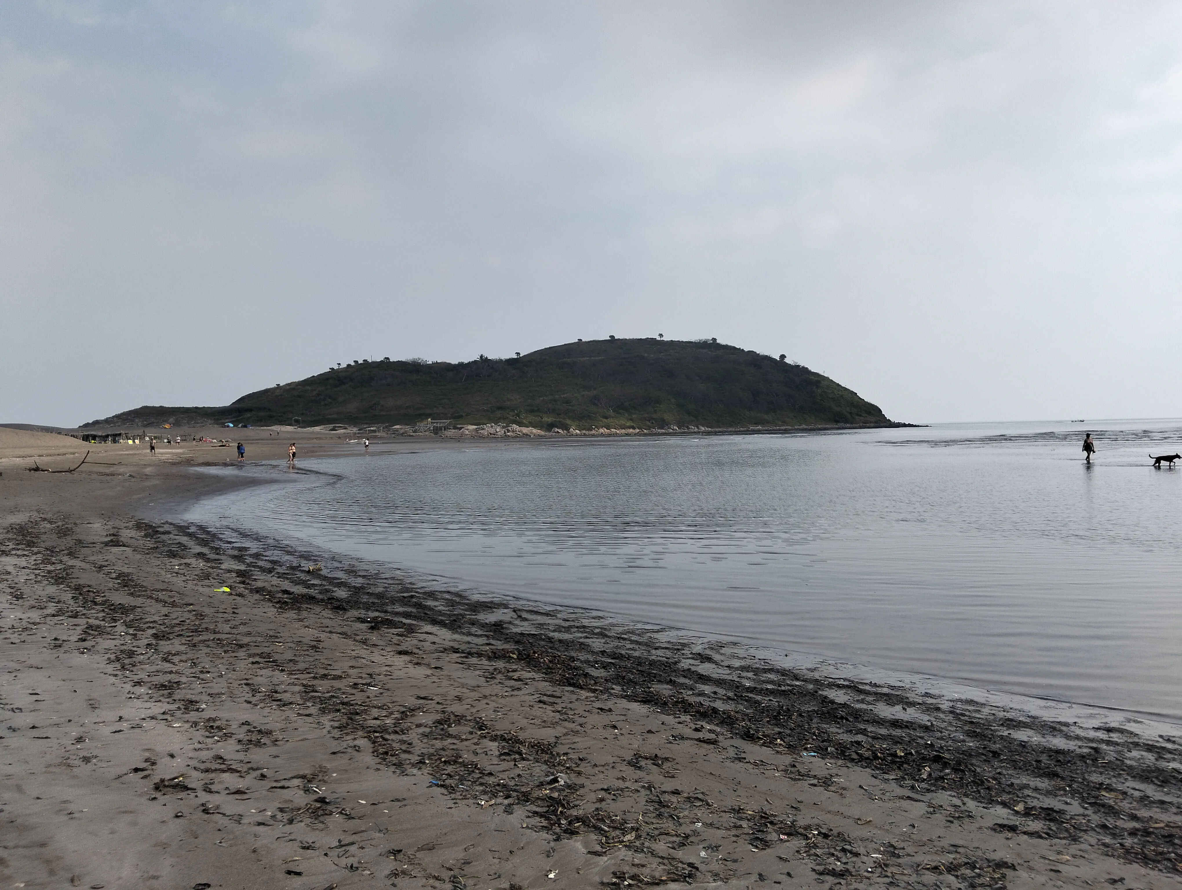
Sea side view of Villa Rica de la Veracruz, along with La Quebrada on the left, Laguna Madre on the right, and El Amarradero de Cortés on the background
Today Villa Rica’s beaches are a tourist attraction, where you can walk up La Quebrada for some stunning views, fishing spots, or pay a ferry boat to guide you to the Amarradero.
Its not just tombs though, there are some other interesting spaces, like the ones I’ll show in these pictures. Also because I want to include them but don’t know where

A seperation for one of the cementeries. Isn’t it weird that one of the tombs sits just next to the stairs?

A foundation for a structure long gone. Maybe they sold picadas there?
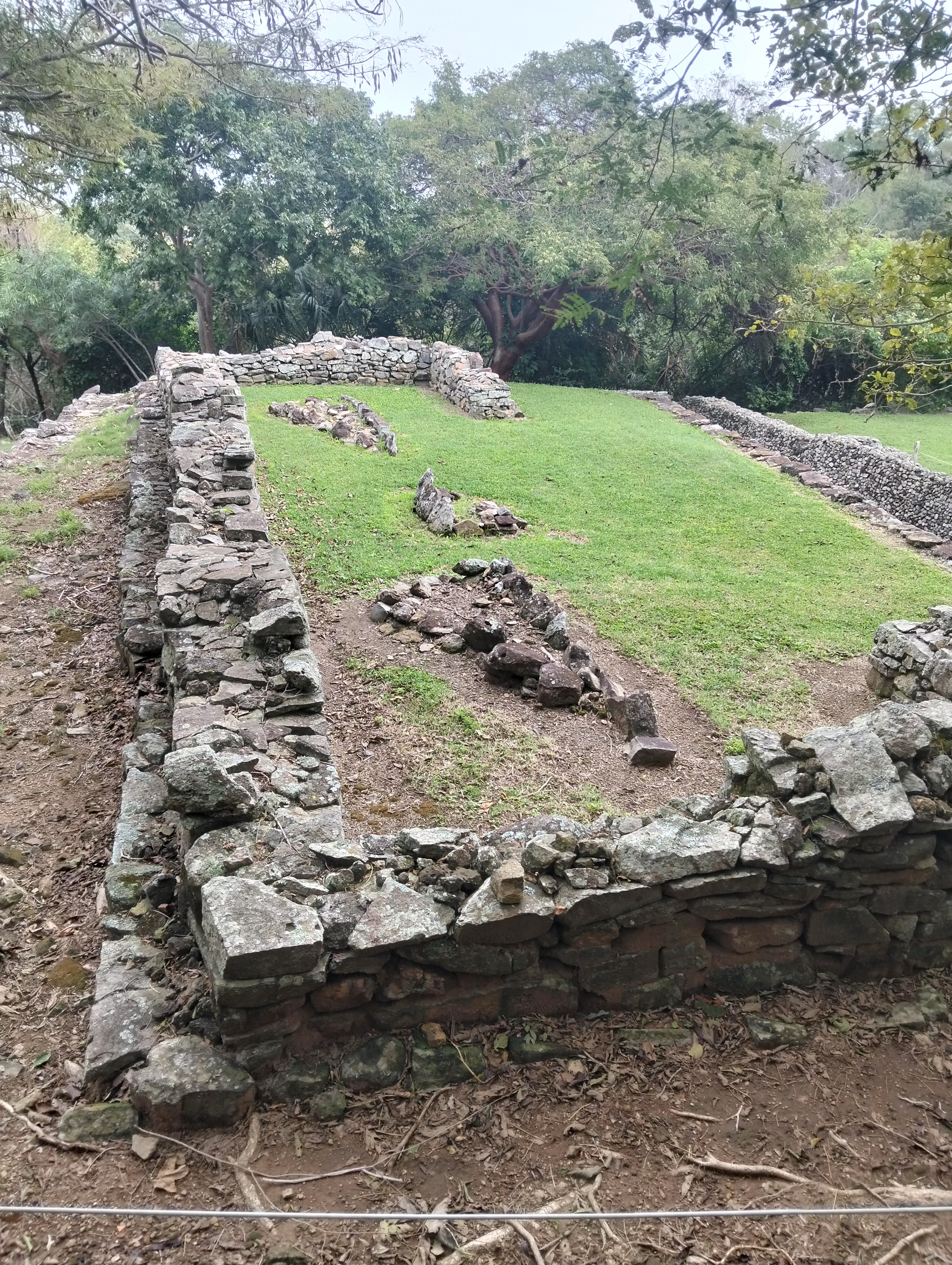
Another foundation, a bit more preserved. Who lived here?
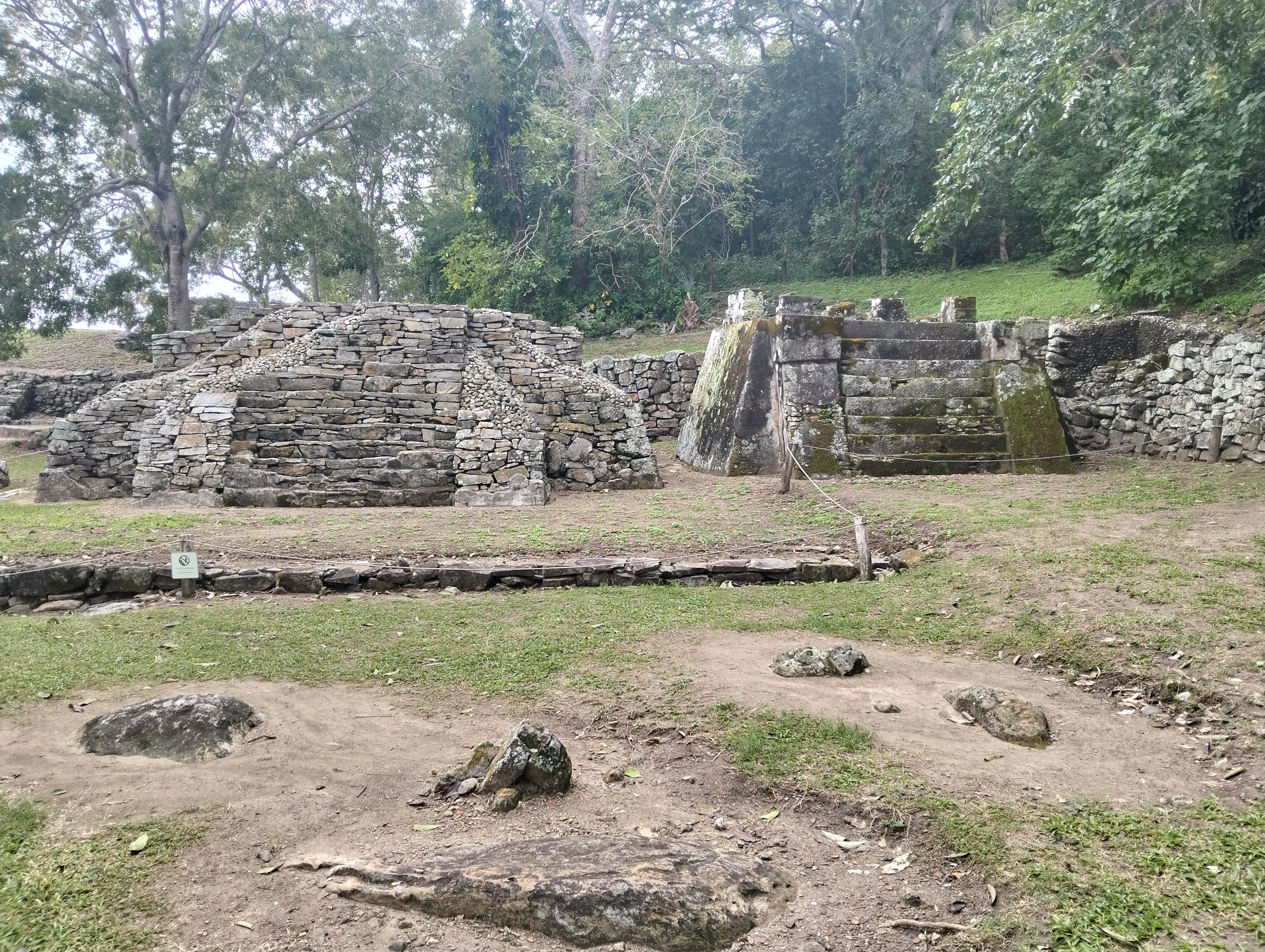
Two tombs that are actually pyramids. Most likely belonged to nobles.
What intrigues more about the last photo is the fact these two tombs share different styles. One is primarilaly just rock and pebbles, while the second shares its style with the rest of the mausoleums. I believe the left one was made more recently, just at the end of Quiahuiztlan before it was abandoned.
The beach of Villa Rica
We also visited Villa Rica, which is just right next to Quiahuiztlan. We went to the beach, and had the excelent idea of walking to La Quebrada. It took us like 20 minutes to get there, and my sister got tired after all that walking. I don’t think she had in mind just how much we had to walk.
From what I heard from tour guides, La Quebrada was the place Hernán Cortés took the sailors who did mutiny on him and wanted to return to Spain instead. Their punishments depended on their ranking, which included hanging, and mutilation of fingers and other parts. After he did this, he asked if any other members wanted to return home. No one wanted to return after that incident.
La Quebrada, as seen from La Villa Rica beach. The hut you can see on the background is where the path to getting up the mount starts.
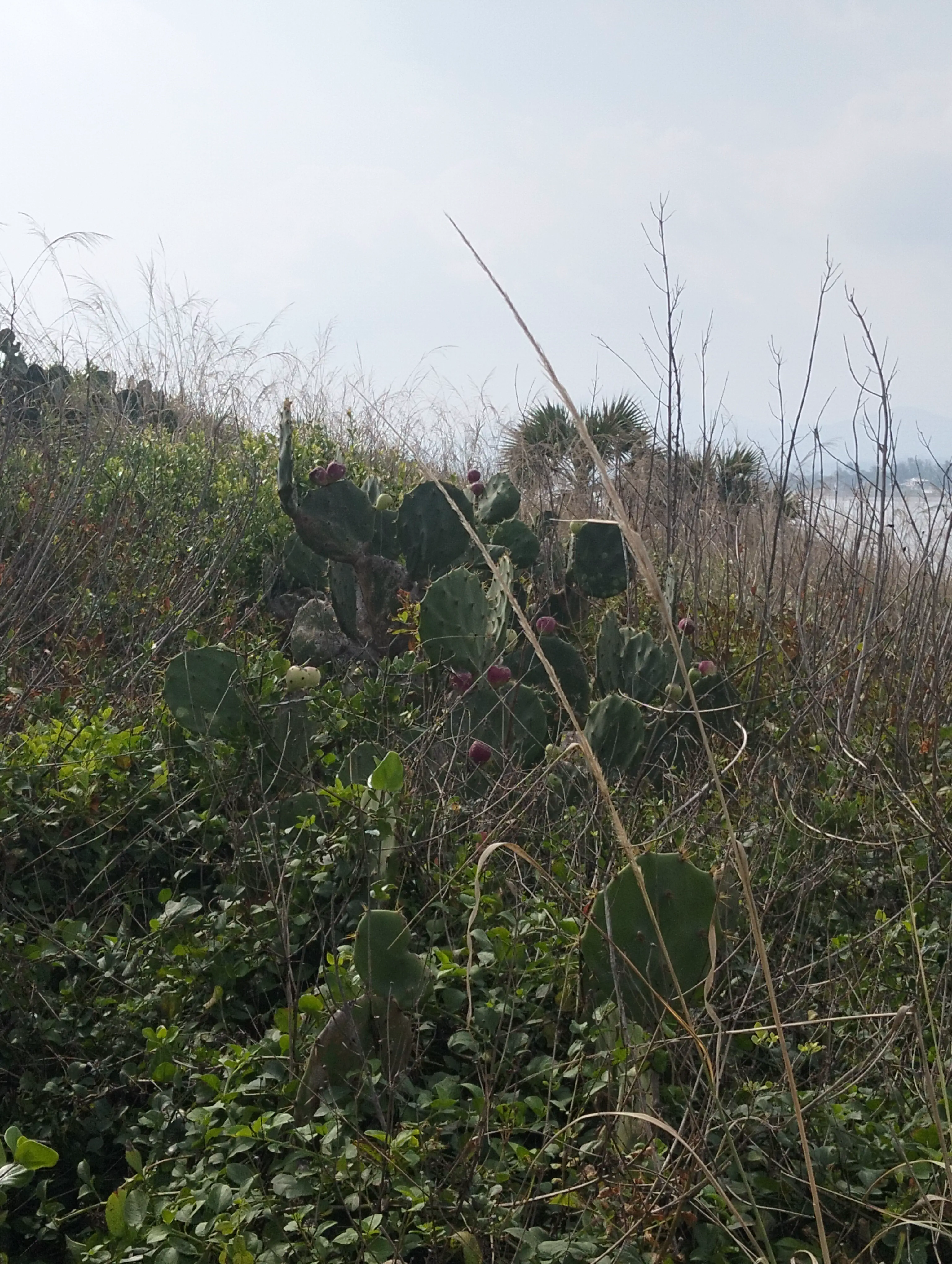
Some tunas!
Now, you may be wondering why La Quebrada is named like that. It’s because of the rock formations that can be seen when you climb it. It’s broken, like if you split in two a geode and found its crystals inside. Look for yourself.
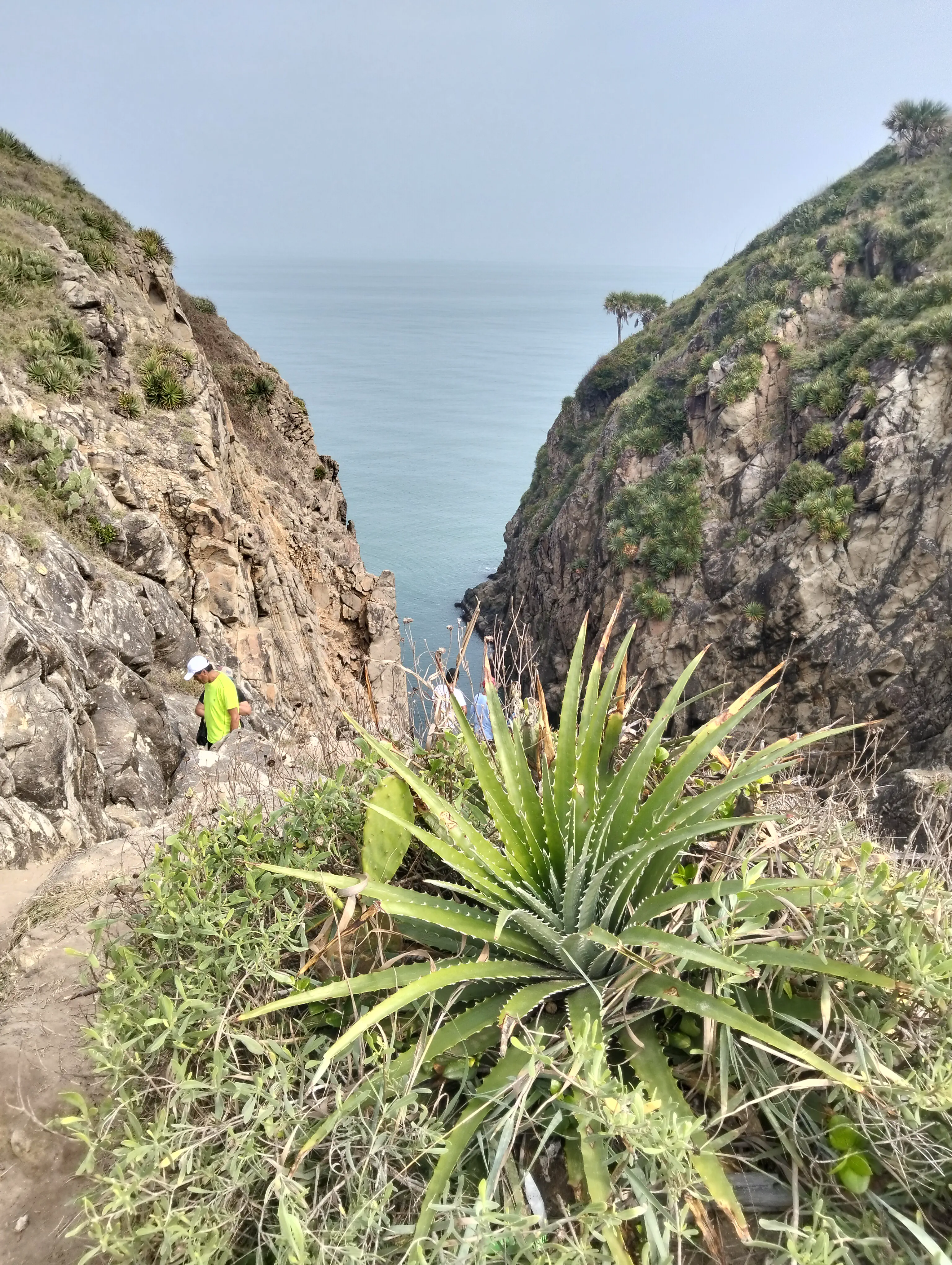
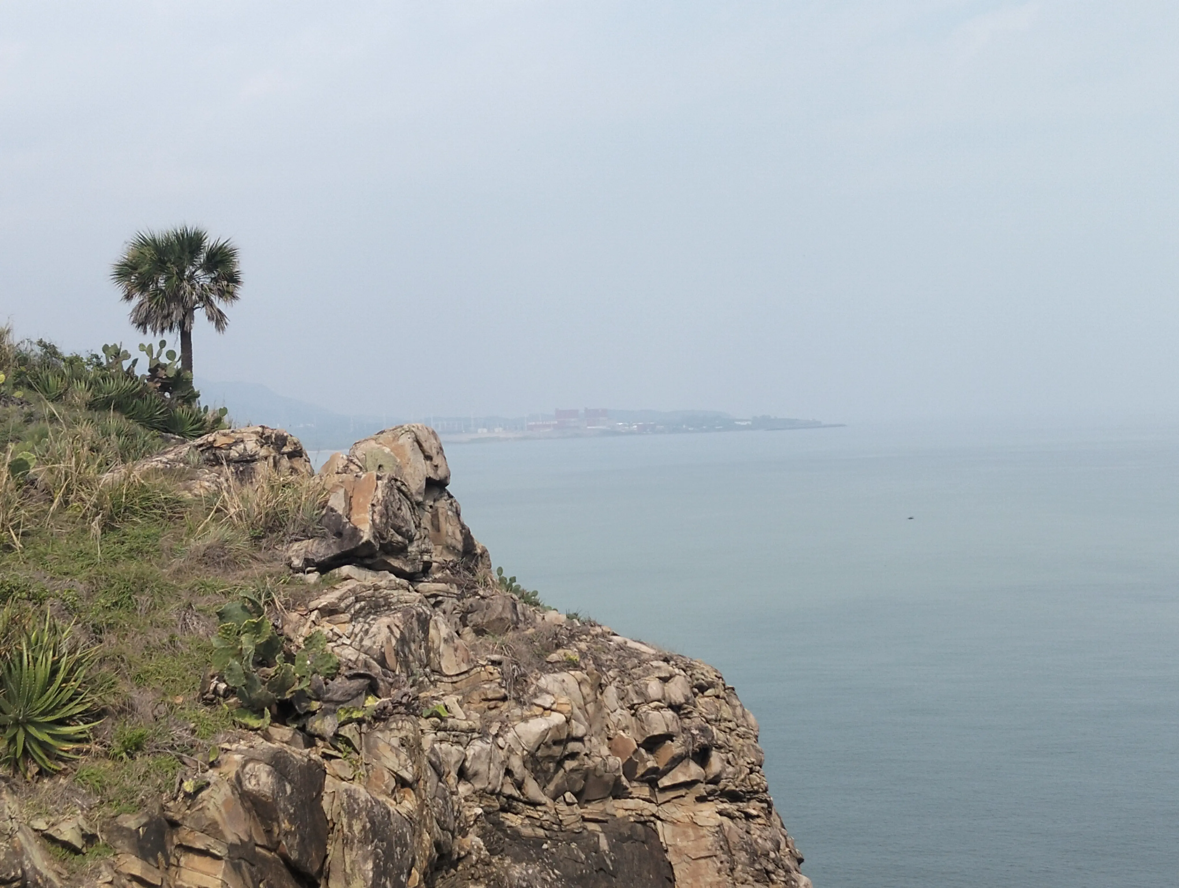
Also, the nuclear power plant Laguna Verde can be seen from the top. I didn’t knew it was so close to Quiahuiztlan!
At the top, a stairway was made for you to descend to the formation itself. They were steep, so only I managed to climb down. Here’s some of the pictures I took on my journey there.
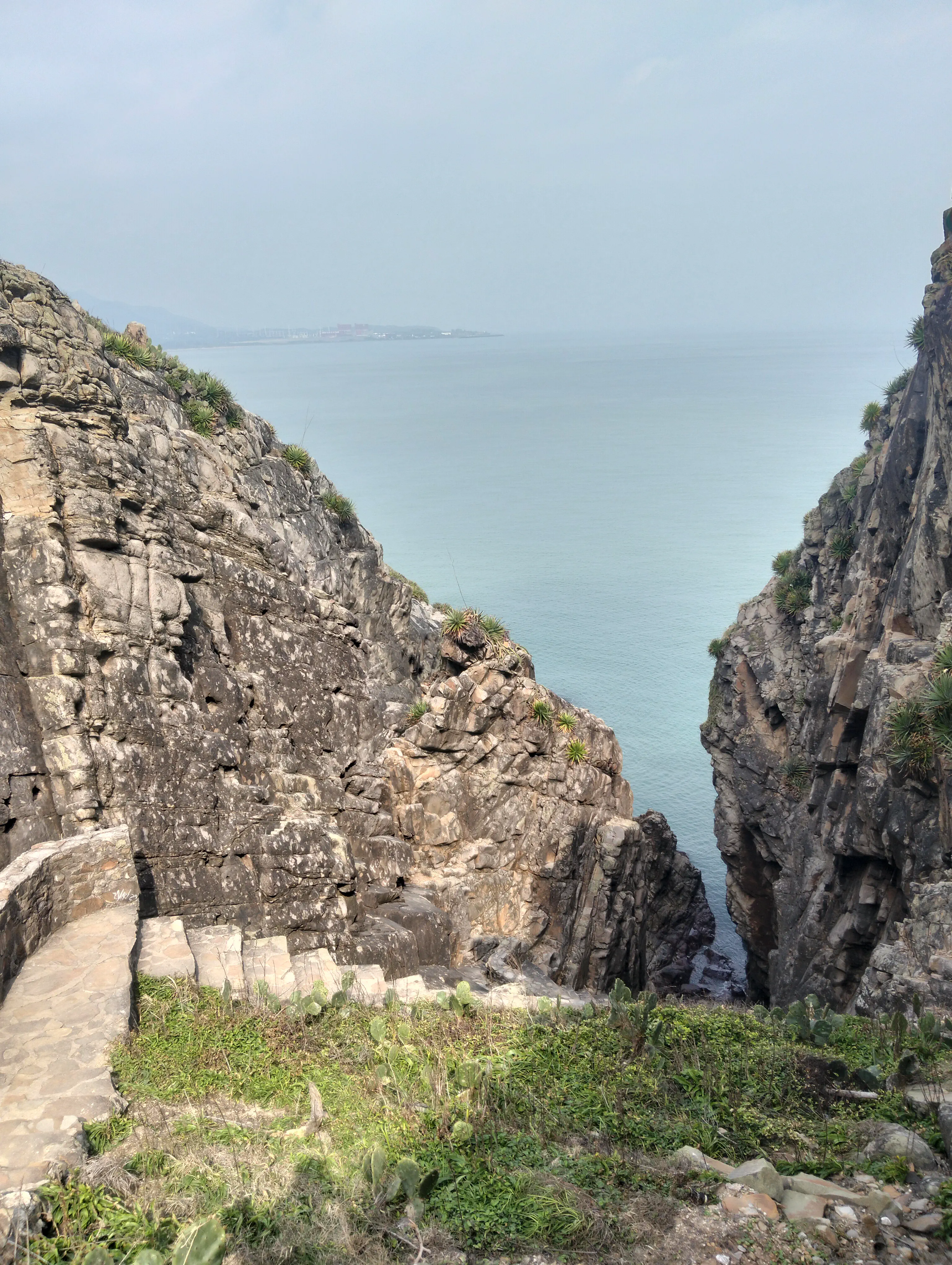
The top of La Quebrada. Laguna Verde can be seen on the background, and below some huge steps I need to climb down.
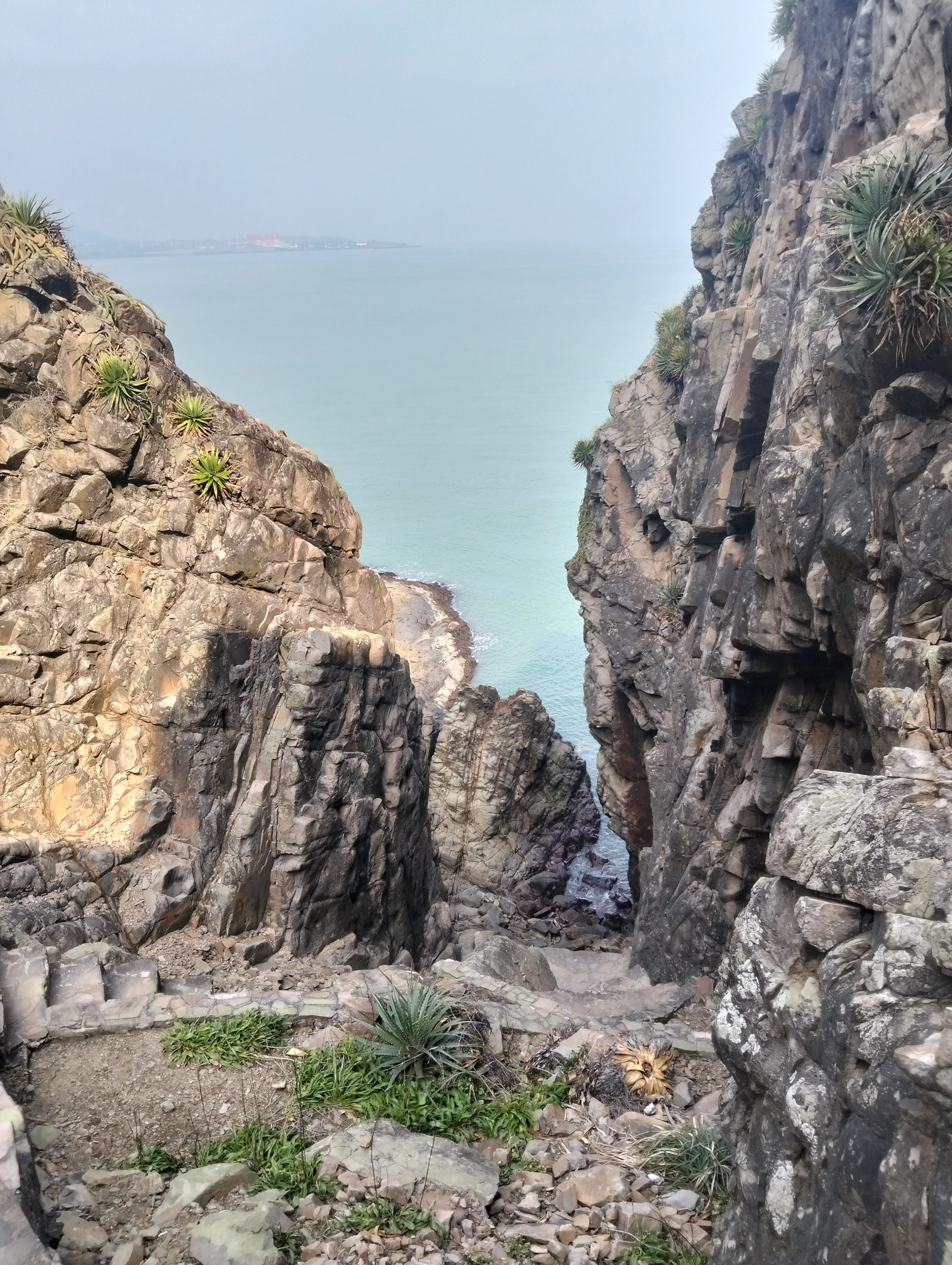
I was at the middle of my track when I took this photo, and the formation of La Quebrada is best seen here.
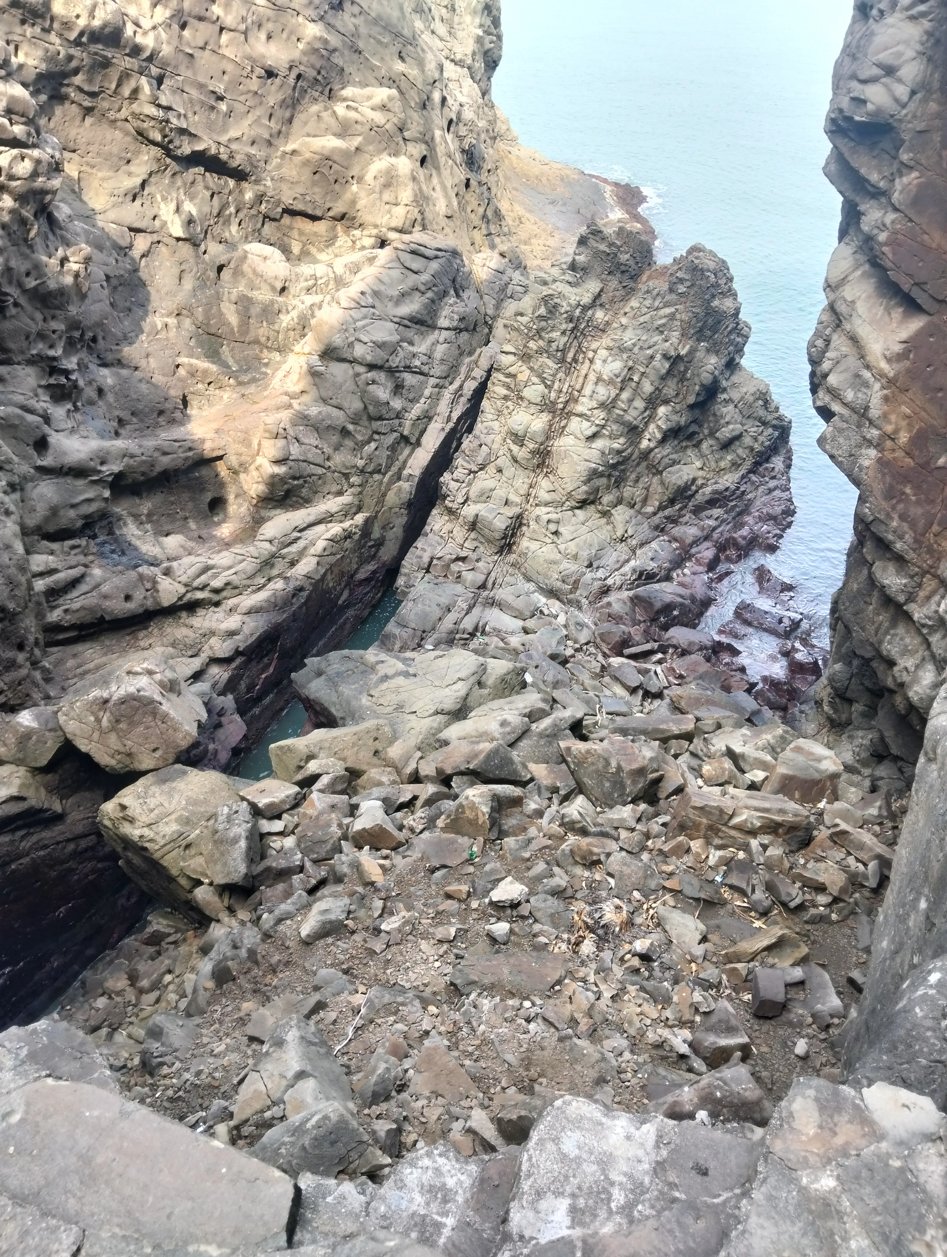
At the bottom of the stairs you can step down to the coast. Just be careful and whatever you do, don’t drown.
Finally, huge shoutouts to this stick we found on the beach. It helped a LOT with walking, especially when climbing up and down La Quebrada.
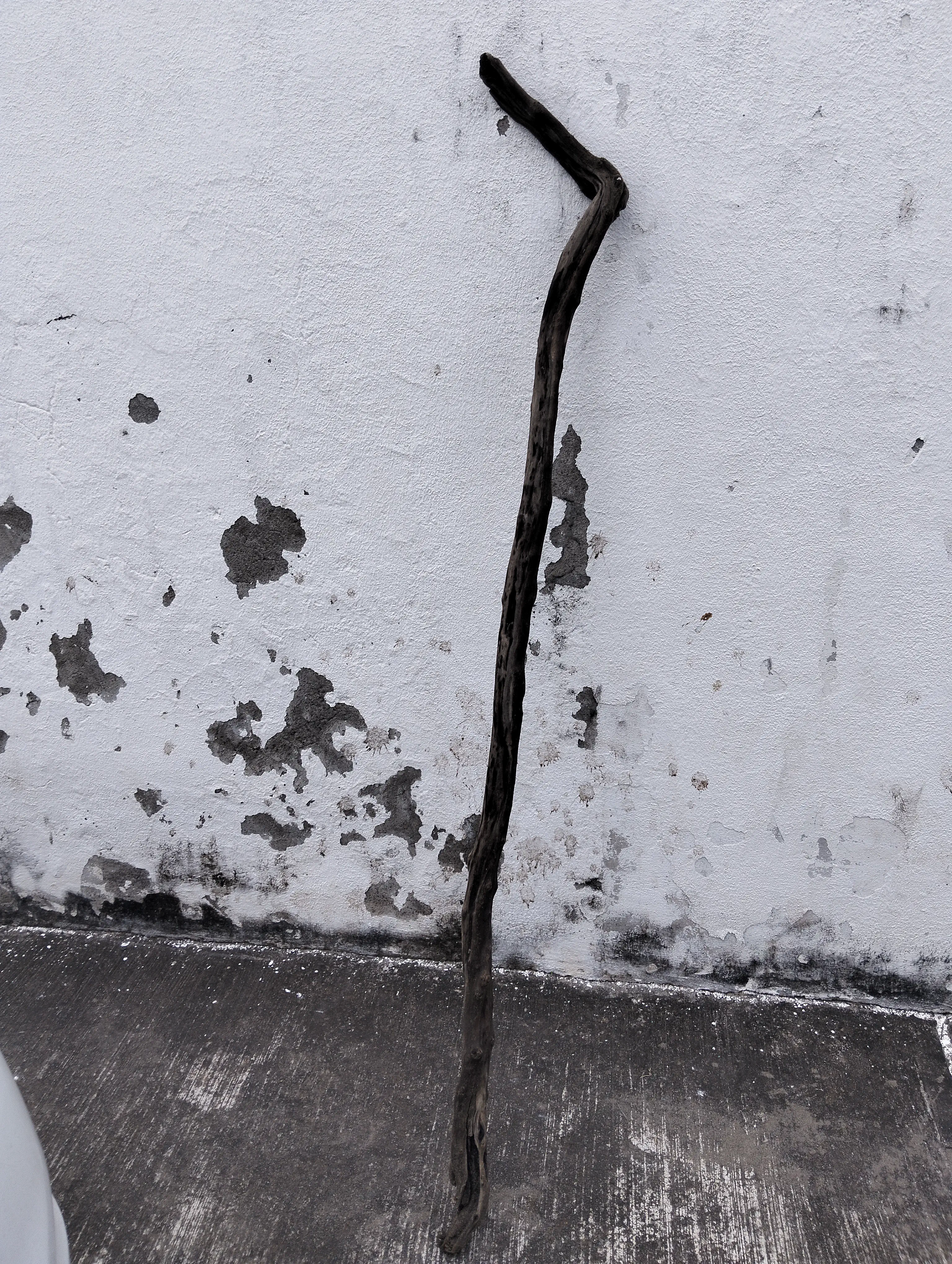
A beautiful walking stick.
That should be everything for today. Toodles!